Natural Resources Program
We are committed to Development Services’ mission of partnering with the community to build a livable, sustainable, and safe City by ensuring compliance with the critical area and shoreline codes. Our team provides high quality customer service to help our customers understand critical areas in terms of their ecological functions, potential hazards, and the permitting process for a successful and environmentally sound project.
Critical Areas Ordinance (CAO) Update
We are updating the City’s Critical Areas Code. Learn more.
What are Critical Areas?
- Wetlands
- Fish and Wildlife Habitat Conservation Areas
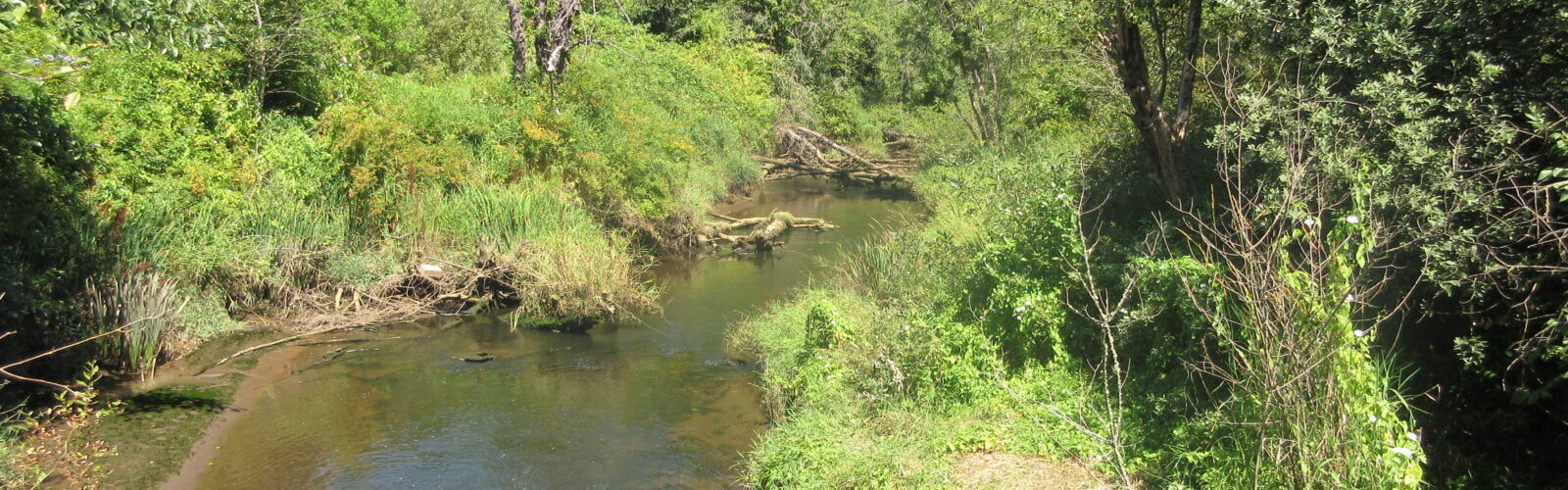
- Streams
- Biodiversity Areas and Corridors
- Oregon White Oak Trees and Woodlands
- Frequently flooded areas
- Geologically Hazardous Areas
- Critical Aquifer Recharge Areas
Importance of Critical Area Protections
Some regulations around critical areas reduce safety risks to the public and our infrastructure. Without proper planning and implementation of critical area codes, geologic hazard zones, such as steep slopes, may not be managed correctly for development. Washington State adopted the Growth Management Act (GMA) in 1990 in order to preserve the natural environment. The City is required to develop policies and regulations to protect the functions and values of critical areas using the best available science.
We invest in protecting our habitats and ecosystems, which is why the City of Tacoma Municipal Code (TMC) Chapter 13.11 Critical Areas Preservation and the Shoreline Master Program, TMC Title 19 were created. These chapters outline regulations that protect critical areas.
While these codes are meant to cover all development scenarios, it is not possible to create a one size fits all approach when it comes to the natural environment, which doesn’t follow property lines. State agencies, including Washington State Department of Natural Resources, Washington State Fish and Wildlife Department, and Department of Ecology are also involved in determining critical areas and providing guidance on regulations to local governments.
Critical Areas Benefits
Protecting critical areas is vital to maintaining healthy habitat for fish and wildlife species and preserving our community’s livability by providing green space and enhancing public health and safety.
- Critical Areas provide many ecosystem services such as:
- Flood retention
- Water Quality Enhancement
- Cleaner Air
What To Do If You Have a Critical Area on Your Property
The Natural Resources group is a great resource to help you determine what to do next. Being a critical areas steward is an important job, and we are here to help you with your development around these important areas. Learn about how to maintain and care for your critical area and understand critical area regulations by reading our resources or contacting us with questions. If you have a critical area, and want more information about how to comply with TMC Ch. 13.11, please reach out to our Natural Resources Specialists in the City’s Planning and Development Services Department at (253) 591-5030 and follow the prompts to “Land Use and Zoning,” or email zoning@tacoma.gov. Additional information can be found on the Critical Areas Permitting website.
Frequently Asked Questions
-
Critical areas include the following areas and ecosystems;
- Wetlands
- Fish and Wildlife Habitat Conservation Areas
- Streams
- Biodiversity Areas and Corridors
- Oregon White Oak Trees and Woodlands
- Frequently flooded areas
- Geologically Hazardous Areas
- Critical Aquifer Recharge Areas
Protecting critical areas is vital to maintaining healthy habitat for fish and wildlife species and preserving our community’s livability by providing green space and enhancing public health and safety. Critical areas provide many ecosystem services such as flood retention, water quality enhancement, and cleaner air. Some regulations around critical areas reduce safety risks to the public and our infrastructure. Without proper planning and implementation of critical area codes, geologic hazard zones, such as steep slopes, are not managed correctly for development. Washington State adopted the Growth Management Act in 1990 in order to preserve the natural environment. The City is required to develop policies and regulations to protect the functions and values of critical areas using the best available science.
-
Fish and Wildlife Habitat Conservation Areas (FWHCA) are areas identified as being of critical importance to the maintenance of fish and wildlife species. All Fish and Wildlife Habitat Conservation Areas are designated as critical areas.
A full list of FWHCA can be found in Washington Administrative Code 365-190-130.
In addition, all Priority Habitat and Species listed by Washington Department of Fish and Wildlife are considered regulated FWHCA.
A full list of City of Tacoma regulated FWHCA can be found in TMC Title 13.11 and TMC Title 19. The following FWHCA are some of the most common in the City of Tacoma:
- Pacific (Western) pond turtle
- Streams and riparian areas
- Oregon White Oak Trees and Woodlands
- Biodiversity Areas and Corridors
- Marine waters
- Lakes and ponds
-
Critical areas are located throughout the City on both public and private property. Critical areas are within many of the City’s parks, such as Point Defiance and Swan Creek, while other critical areas are on private property such as a wetland in a resident’s backyard. Some critical areas are easily identified, such as steep slopes, streams, and wetlands, yet other types of critical areas may be more difficult to determine like geologic hazard zones and biodiversity areas. Many critical areas, but not all are mapped on our City of Tacoma site.
-
The City of Tacoma Municipal Code (TMC) Chapter 13.11 Critical Areas Preservation and the Shoreline Master Program, TMC Title 19 were created in order to implement the Growth Management Act (GMA) protections required by Washington State. These chapters outline regulations that protect critical areas. While these codes are meant to cover all development scenarios, it is not possible to create a one size fits all approach when it comes to the natural environment which doesn’t play by straight lines and parcels. State agencies, including Washington State Department of Natural Resources, Washington State Fish and Wildlife Department, and Department of Ecology are also involved in determining critical areas and providing guidance on regulations to local governments.
-
No. Regulations that protect critical areas are meant to prevent public harm by reducing risk in hazard areas and protecting natural environmental functions. These regulations restrict uses and development that could affect a critical area, but do not eliminate all use of private property. If you have a critical area on your property, it may require a modification to your development, maintenance or landscape plans. The City’s permitting staff can help you explore options to comply with TMC Ch. 13.11 and Title 19.
-
Yes. RCW 36.70A.172(1) requires counties and cities to protect the functions and values of critical areas. This can be done in a variety of ways and each case is unique in its challenges and opportunities in planning successful development alongside critical areas. This could mean maintaining a buffer (protective zone) around a wetland on a site, setting back buildings from streams, or maintaining trees on a steep slope to prevent landslides. The Critical Area Preservation Ordinance and Shoreline Master Program are meant to not only protect fish and wildlife, but also to protect your investment from issues like flooding, and landslides.
-
The City maintains a mapped inventory of known critical areas and areas that are likely to have critical areas. We maintain an inventory of sites that have been physically inspected and are known to contain critical areas, as well as rely on satellite/LIDAR mapping of geographical critical areas such as steep slopes and critical aquifer recharge areas. However, not all properties have been investigated and the map is advisory. Properties that are not mapped may still require a site investigation by the City or a qualified professional to confirm the presence or absence of critical areas. You can find the map by going to tacomapermits.org and selecting “Explore Maps” and then “Dart Map.”
-
You can find critical areas regulations for development in the Land Use Regulatory Code. Chapter 13.11 in Title 13 is the Critical Area Preservation Ordinance and review our outreach materials for properly maintaining critical areas on your property after development.
- Check all available information on this website including maps with known wetlands, streams, biodiversity areas, and slopes.
- Call the City at (253) 591-5030 and follow the prompts to “Land Use and Zoning” or email zoning@tacoma.gov.
- Hire a qualified professional to obtain specific information on your property.
-
The Natural Resources group is a great resource to help you determine what to do next. Being a critical areas steward is an important job, and we are here to help you with your development around these important areas. Learn about how to maintain and care for your critical area and understand critical area regulations by reading our resources or contacting us with questions. If you have a critical area, and want more information about how to comply with TMC Ch. 13.11, please reach out to our Natural Resources Specialists in the City’s Planning and Development Services Department at (253) 591-5030 and follow the prompts to “Land Use and Zoning.”