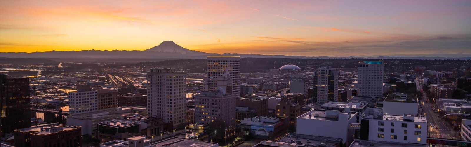
Watershed Planning
In Tacoma, most stormwater flows untreated into local waterways. That means if it hits the ground, it hits the Sound! As Tacoma continues to grow, with more residents, traffic, and the impacts of climate change, the pressure on our environment increases. Managing stormwater is critical to protecting our natural resources and community.
What is a Watershed?
A watershed is an area of land where all the water from streams, rainfall, and snowmelt drains to a common point, such as a river, bay, or stream channel. Watersheds are shaped by both the natural landscape—including steep slopes, streams, wetlands, and shorelines—and the built environment, such as streets, sidewalks, parking lots, and the city’s stormwater collection system.
When pollutants like trash, fertilizers, oil, soaps, pet waste, or toxic chemicals are carried into the watershed by stormwater runoff, they can harm our environment in many ways. These contaminants affect water quality, harm wildlife, and degrade the health of our ecosystems—ultimately impacting the entire community.
Tacoma’s Watersheds
The City of Tacoma is divided into nine watersheds, each with unique characteristics, challenges, and opportunities for improvement. These watersheds drain to specific local receiving waters, each with its own significant water bodies. Below you’ll find more information about each watershed. The UWP Plan addresses our watershed needs with solutions to support a thriving Puget Sound.
-
Drainage Area: 5,001 acres
Significant Waterbodies: Commencement Bay, Puget Creek, Mason Creek, Buckley Creek
Key Areas: 6th Avenue, Proctor Business District, Ruston Way, Westgate Shopping Center, North End Treatment Plant, Former ASARCO Smelter Site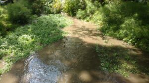
Historical Context:
The Puyallup Tribe of Indians historically inhabited this area, utilizing the waterfront for hunting and fishing. After non-native settlers arrived, industrial businesses like sawmills and grain terminals were established along the shoreline.Geology:
Sandy soils over clay layers; steep slopes are located along the northern edge.Critical Issues:
- Habitat Degradation: Impaired nearshore habitats along Commencement Bay
- Erosion: Ongoing erosion of steep slopes
- Contamination: Lead and arsenic contamination in the Smelter Plume area
- Fish Passage Barriers: Limited fish access to creeks due to infrastructure (e.g., Ruston Way, railroads)
- Conservation Efforts: Puget Creek habitat improvements, including a fish ladder built in 1997
-
Drainage Area: 5,868 acres
Significant Waterbodies: Thea Foss Waterway, Wheeler-Osgood Waterway, Commencement Bay
Key Areas: Tacoma Tideflats, South Tacoma Way, Downtown Regional Growth Center, Pacific Avenue business center, Lincoln District business center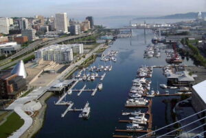
Historical Context:
In the 1960s, natural drainages like creeks and groundwater were redirected into pipe systems, which now carry baseflow to the Thea Foss Waterway year-round. There are no remaining natural streams in the watershed. The Thea Foss and Wheeler-Osgood Waterways were originally part of the Puyallup River Delta but were industrialized in the late 1800s, playing a significant role in Tacoma’s marine industry.Geology:
The original delta land was heavily modified for industrial use, leading to the construction of artificial waterways.Critical Issues:
- Superfund Site: Thea Foss and Wheeler-Osgood Waterways became designated Superfund sites in 1983 as part of the Commencement
- Bay Nearshore/Tideflats Site.
- Sediment Contamination: Sediment remediation, including dredging and capping, was completed in 2006 under EPA oversight.
- Ongoing Monitoring: Routine monitoring ensures the continued effectiveness of sediment remediation.
- Redevelopment: The Thea Foss waterfront has been redeveloped with mixed-use residential areas, museums, marinas, and a waterfront esplanade.
-
Drainage Area: 2,979 acres
Significant Waterbodies: Puyallup River, Swan Creek, First Creek
Key Areas: Salishan Neighborhood, McKinley Neighborhood, Lower and Upper Portland Avenue Business Districts, Dome District, Port of Tacoma, I-5, Highway 509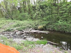
Historical Context:
The Lower Puyallup Watershed is home to deep cultural and historical ties with the Puyallup Tribe of Indians. The mouth of the Puyallup River was the main village site of the Tribe, and this region was a crossroads for many other tribes. Following the Medicine Creek Treaty of 1854, the Tribe secured the rights to fish, hunt, and gather in their ancestral lands. These rights were fiercely defended through the Fishing Wars of the 1960s and 1970s and ultimately protected by the Boldt Decision of 1974, granting the Tribe co-management of the region’s salmon fisheries.Geology:
The lower Puyallup River forms a salt-wedge estuary where fresh river water overlays denser marine water from Commencement Bay. Swan Creek and First Creek are significant tributaries to this watershed.Critical Issues:
- Salmon Habitat: The Puyallup River serves as a critical migration route for several species of salmon. Four fish hatcheries are located upstream.
- Estuarine Dynamics: The lower Puyallup estuary provides unique ecological conditions, important for aquatic species.
- Swan Creek Restoration: A 12-acre restoration project was completed in 2001, improving habitat and stormwater management.
- First Creek Action Plan: First Creek, an important cultural and stormwater asset, has suffered from pollution and development impacts. A community-driven action plan was created in 2013 to restore the creek and its surrounding area.
-
Drainage Area: 2,615 acres
Significant Waterbodies: Middle Waterway, Sitcum Waterway, Blair Waterway, Wapato Creek, Puyallup River, Commencement Bay
Key Areas: Port of Tacoma, heavy industrial zones, Port Maritime, and Industrial areas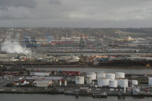
Historical Context:
The Tideflats watershed, once an extensive tidal flat and wetland estuary at the mouth of the Puyallup River, was a major site for the Puyallup Tribe of Indians. This area was a key fishing ground and remains significant to the Tribe. However, urbanization and extensive flood control infrastructure, including dams and levees, have transformed the river and its tributaries. Today, less than 5% of the original estuarine habitat remains, largely replaced by the Port of Tacoma and other industrial developments.Geology:
Once a natural estuarine delta, this area has been substantially modified for industrial use, with waterways and creeks redirected and contained within port infrastructure.Critical Issues:
- Superfund Cleanup Sites: The Middle and Sitcum Waterways are part of the Commencement Bay Nearshore/Tideflats Superfund site. Sediment remediation was completed in the Middle Waterway in 2004 and in the Sitcum Waterway in 1994, under EPA oversight.
- Habitat Loss: Significant estuarine and tidal flat habitat loss has occurred due to industrial expansion, leaving minimal natural habitat.
- Tideflats Subarea Plan: Tacoma is working on a Tideflats Subarea Plan as part of the One Tacoma Comprehensive Plan, in partnership with the Port of Tacoma and Puyallup Tribe. This initiative will engage the community in planning for future use and preservation within the Tideflats area.
-
Drainage Area: 3,385 acres
Significant Waterbodies: Hylebos Creek, Hylebos Waterway, Commencement Bay
Key Areas: Marine View Drive (Highway 509), bluffs, and steep slopes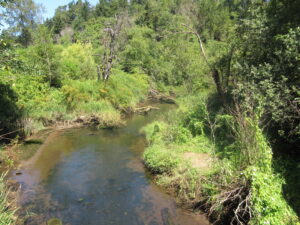
Historical Context:
The Northeast Tacoma Watershed is defined by steep slopes, bluffs, and seasonal water flows. Marine View Drive separates the residential upland areas from industrial properties bordering the Hylebos Waterway. The combination of sandy soils, steep inclines, and groundwater seeps results in frequent erosion and landslides, particularly in winter.Geology:
The watershed has sandy soils and steep bluffs prone to seasonal erosion and landslides, especially along Marine View Drive.Critical Issues:
- Hylebos Creek: This is the only fish-bearing stream in the watershed, though only a small portion is within Tacoma city limits. Despite extensive development impacts, community efforts are ongoing to protect and restore the creek habitat.
- Superfund Cleanup: The Hylebos Waterway is part of the Commencement Bay Nearshore Tideflats Superfund Site. Cleanup efforts have included dredging, shoreline capping, and monitoring. The area has experienced partial recontamination, and EPA is evaluating further actions.
- Mitigation Sites: Several key habitat mitigation areas exist within this watershed, including the Lower Hylebos Creek Mitigation Site, Hylebos Creek Estuarine Marsh Restoration Site, and the Port of Tacoma Place of Circling Waters mitigation site.
-
Drainage Area: 2,200 acres
Significant Waterbodies: Gold Creek, Narrows Creek, Crystal Creek, Crystal Springs Creek, Marinera Creek, Titlow Park Creek, Titlow Lagoon, Narrows Passage in Puget Sound
Key Areas: Point Defiance Park, Titlow Beach, 6th Avenue commercial area
Historical Context:
The Western Slopes Watershed in northwest Tacoma consists of steep, residential slopes with shallow groundwater, underground springs, and unstable soil conditions. This green belt between Point Defiance Park and Titlow Beach forms an essential wildlife corridor, supporting diverse species such as deer, raccoons, and river otters.Geology:
The watershed is characterized by steep slopes, shallow groundwater, and unstable soils, which lead to slope instability, especially near the waterfront.Critical Issues:
- Slope Development: Development on steep slopes and tree removal for Puget Sound views increase the risk of slope instability and erosion.
- Railway Impact: The BNSF railway runs along the waterfront at the base of steep slopes, where culverts direct stormwater and creek flows under the tracks into Puget Sound.
- Salmon Beach Community: Accessible only by water or steep stairs, Salmon Beach experiences groundwater discharges and has a history of surface and deep-seated landslides, occasionally triggered by seismic activity.
-
Drainage Area: 1,867 acres
Significant Waterbodies: China Lake, TCC Campus Wetlands, Leach Creek, Chambers Creek
Key Areas: State Route 16, Highway 163 (Pearl Street), Westgate Shopping Center, James Center, Highland Hills Shopping Center, Tacoma Community College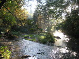
Historical Context:
The Leach Creek Watershed, located in west-central Tacoma, spans residential, commercial, and educational areas. In 1961, a holding basin was constructed to manage water flow from Leach Creek and parts of Fircrest, with an earthen dam created to contain high flows. A pump station was added in 1991 to divert excess water to the Thea Foss Waterway during high flow events.Geology:
The watershed is highly urbanized, with a mix of natural and modified flow systems. The Leach Creek holding basin controls water flow, feeding into Leach Creek and eventually Chambers Creek.Critical Issues:
- Spawning Habitat: Salmonid spawning grounds exist in the lower creek near Chambers Creek, though upper creek areas suffer from reduced vegetation, channeling, and storm-related erosion.
- Urban Impact: Homeowner activities, including vegetation removal and water channeling, have affected creek health and habitat.
- Superfund Site: A portion of the Tacoma Landfill Superfund site is within this watershed, presenting ongoing environmental concerns and monitoring.
-
Drainage Area: 7,130 acres
Significant Waterbodies: Snake Lake, Wapato Lake, Ward’s Lake, Flett Wetlands, Flett Creek, Chambers Creek
Key Areas: South Tacoma, Clover Park Technical College, South Tacoma Groundwater Protection District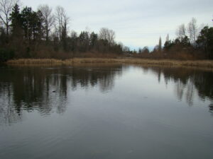
Historical Context:
The Flett Creek watershed, primarily residential with some light commercial and industrial areas, spans South Tacoma and parts of Pierce County. Clover Park Technical College has preserved part of the historic Flett Dairy site, now the Flett Wetlands, as open space for student training in water quality and environmental sampling.Geology:
This watershed is characterized by highly permeable soils and large areas of impervious surfaces like roads and rooftops. The South Tacoma Groundwater Protection District and multiple drinking water wellhead protection areas are also part of this watershed.Critical Issues:
- Stormwater Management: The watershed’s hard surfaces cause “flashy” high flows during winter rains and low flows in the dry summer, which are managed through holding basins and the Flett Wetlands pump station.
- Salmon Habitat: Flett Creek flows into Chambers Creek, which supports salmon populations and eventually discharges into Chambers Bay and the Narrows.
- Superfund Site: The South Tacoma Channel Superfund Site (formerly the South Tacoma Swamp) is within this watershed, necessitating ongoing environmental monitoring and protection efforts.
-
Drainage Area: 434 acres
Significant Waterbodies: Dumas Bay, Joe’s Creek
Key Areas: Bordering unincorporated Pierce County, adjacent to the City of Federal Way, Dash Point State Park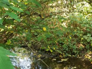
Historical Context:
The Joe’s Creek Watershed is Tacoma’s smallest and includes portions that drain to Joe’s Creek in Federal Way as well as areas that drain south of Dumas Bay. The watershed is largely residential, with single-family and multi-family homes, along with some open spaces and undeveloped areas.Geology:
This watershed includes residential areas with intermittent open spaces. The drainage pattern splits, with eastern areas draining to Joe’s Creek and western portions draining toward Dumas Bay.Critical Issues:
- Salmon Habitat: Joe’s Creek, primarily in Federal Way, supports salmon species, especially in its lower reaches, which provide high-quality spawning and rearing habitat for salmonids.
- Stormwater Impact: Joe’s Creek receives stormwater discharges from Tacoma, impacting the creek’s flow and habitat quality.
The City’s Environmental Services Department developed the Urban Watershed Protection (UWP) Plan to address the growing need for stormwater management. This plan helps identify and prioritize areas that require action to manage stormwater effectively. The goal is to protect people, property, and local ecosystems from the impacts of stormwater flooding and pollution by using a clear, strategic approach to problem-solving.
The UWP Plan is built on input from the Interdisciplinary Team (IDT) and offers a transparent, data-driven approach to rank stormwater issues and find solutions that benefit both water quality and habitat. This plan also takes into account Tacoma’s community and neighborhood needs.
To learn more, you can view the full UWP Plan and Appendices to explore the details.
-
Key Highlights of the UWP Plan
- Explanation of the Watershed Insights Tool that was used to prioritize sub-basins for stormwater solutions based on watershed conditions and community needs (Chapter 4 & Appendix G & H)
- Prioritized recommended actions (Chapter 5)
- Proposed capital improvement projects for regional stormwater treatment facilities (Table 2)
- Programmatic stormwater management activity enhancements (Table 3)
- Implementation approach for stormwater management actions (Chapter 6)
- Priority Areas
The following areas were identified as having the greatest need for stormwater services:
- Lower Puyallup (East Tacoma)
- Flett Creek (South Tacoma)
- Thea Foss Waterway (Tacoma Mall, Lincoln District & Downtown)
- North Tacoma (Schuster/Stadium)
- Tideflats
-
Implementing the UWP Plan
The Environmental Services team is evaluating the feasibility of the recommended actions (Tables 2 & 3). These actions are divided into short-term (one to six years) and long-term (seven to 20 years) goals. Implementing these stormwater improvements will depend on securing funding, resources, partnerships, and collaboration opportunities.
We are currently looking for opportunities for partnerships and funding over the next several years. Please contact us for more information.
Contact: Brandi Lubliner
Phone: (253) 591-5588Email: blubliner@tacoma.gov